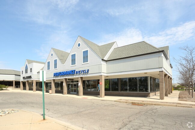
Property Record
3059 Oak Valley Dr, Ann Arbor, MI 48103

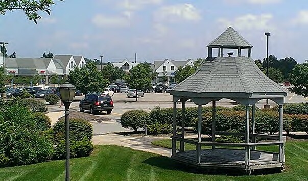
NEARBY LISTINGS FOR SALE OR LEASE
Property Detail
3059 Oak Valley Dr
12-07-275-001
PI 7-5A-1 2/90 (002) L 2367 P 565, 567 COM AT N 1/4 COR SEC 7, TH N 89-19-30 E 783.00 FT, TH S 42-33-55 W 694.77 FT, TH N
Commercialnec
Washtenaw
X
Michigan
26161C0382E
12.48 AC
2025
Washtenaw W of 23
2025
Detroit
414900
Ann Arbor, MI
14,829 SF
DEMOGRAPHICS near 3059 Oak Valley Dr
1 Mile
3 Mile
5 Mile
2024 Total Population
9,934
73,049
145,462
2029 Population
9,975
72,371
143,906
Pop Growth 2024-2029
+ 0.41%
(0.93%)
(1.07%)
Average Age
41
37
37
2024 Total Households
4,441
31,190
60,087
HH Growth 2024-2029
+ 0.07%
(0.86%)
(1.08%)
Median Household Inc
$114,371
$83,014
$82,033
Avg Household Size
2.20
2.10
2.20
2024 Avg HH Vehicles
2.00
2.00
2.00
Median Home Value
$435,009
$433,734
$416,667
Median Year Built
1993
1976
1976
Nearby Places
Map Layers
Map Styles
 Street
 Aerial
- Restaurants
- Banks
- Shops
- Fitness
- Groceries
PUBLIC TRANSPORTATION
COMMUTER RAIL
DRIVE
WALK
Distance
11 min
4.0 mi
AIRPORT
Detroit Metro Wayne County
DRIVE
WALK
Distance
Detroit Metro Wayne County
35 min
26.7 mi
Freight Ports
DRIVE
WALK
Distance
75 min
58.1 mi
SALE & LEASE HISTORY
LISTING DATE
SALE/LEASE

Sep 25, 2016
For Lease
Mar 29, 2017
For Lease
Nearby Properties
Address
Land Use
TOTAL SIZE
Lot Size
Zoning
Address
Land Use
TOTAL SIZE
Lot Size
Zoning
235,070 SF
0.80 AC
D1
Address
Land Use
TOTAL SIZE
Lot Size
Zoning
212,047 SF
1.15 AC
D2
Address
Land Use
TOTAL SIZE
Lot Size
Zoning
186,029 SF
2.06 AC
D2
Address
Land Use
TOTAL SIZE
Lot Size
Zoning
Address
Land Use
TOTAL SIZE
Lot Size
Zoning
211,670 SF
0.54 AC
D1
Address
Land Use
TOTAL SIZE
Lot Size
Zoning
222,126 SF
0.52 AC
D1
Address
Land Use
TOTAL SIZE
Lot Size
Zoning
315,108 SF
6.57 AC
C1B
Address
Land Use
TOTAL SIZE
Lot Size
Zoning
173,885 SF
0.45 AC
D1
Address
Land Use
TOTAL SIZE
Lot Size
Zoning
334,077 SF
20.41 AC
R4B
Address
Land Use
TOTAL SIZE
Lot Size
Zoning
357,978 SF
19.32 AC
R4B
Address
Land Use
TOTAL SIZE
Lot Size
Zoning
140,670 SF
1.63 AC
C2B
Address
Land Use
TOTAL SIZE
Lot Size
Zoning
177,763 SF
0.91 AC
D2
Address
Land Use
TOTAL SIZE
Lot Size
Zoning
303,524 SF
19.40 AC
R4B
Address
Land Use
TOTAL SIZE
Lot Size
Zoning
99,982 SF
0.35 AC
D1
Address
Land Use
TOTAL SIZE
Lot Size
Zoning
140,039 SF
Address
Land Use
TOTAL SIZE
Lot Size
Zoning
271,521 SF
15.11 AC
Address
Land Use
TOTAL SIZE
Lot Size
Zoning
127,076 SF
0.39 AC
D1
Address
Land Use
TOTAL SIZE
Lot Size
Zoning
214,559 SF
16.18 AC
PUD
Address
Land Use
TOTAL SIZE
Lot Size
Zoning
268,002 SF
18.34 AC
Address
Land Use
TOTAL SIZE
Lot Size
Zoning
125,073 SF
0.26 AC
D1
Address
Land Use
TOTAL SIZE
Lot Size
Zoning
137,874 SF
0.55 AC
PUD
Address
Land Use
TOTAL SIZE
Lot Size
Zoning
234,076 SF
24.18 AC
R4A
Address
Land Use
TOTAL SIZE
Lot Size
Zoning
1.19 AC
R4C
Address
Land Use
TOTAL SIZE
Lot Size
Zoning
116,650 SF
0.32 AC
D1
Address
Land Use
TOTAL SIZE
Lot Size
Zoning
111,435 SF
21.38 AC
R4B
Address
Land Use
TOTAL SIZE
Lot Size
Zoning
175,536 SF
12.98 AC
R4B
Address
Land Use
TOTAL SIZE
Lot Size
Zoning
179,981 SF
14.55 AC
R4A
Address
Land Use
TOTAL SIZE
Lot Size
Zoning
88,460 SF
28.50 AC
DI
Address
Land Use
TOTAL SIZE
Lot Size
Zoning
192,726 SF
6.45 AC
O
Address
Land Use
TOTAL SIZE
Lot Size
Zoning
283,290 SF
10.42 AC
O
The World's #1 Commercial Real Estate Marketplace
Connect with us
© 2026 CoStar Group
The information above has been obtained from sources believed reliable. While we do not doubt its accuracy we have not verified it and make no guarantee, warranty or representation about it. It is your responsibility to independently confirm its accuracy and completeness. Any projections, opinions, assumptions, or estimates used are for example only and do not represent the current or future performance of the property. The value of this transaction to you depends on tax and other factors which should be evaluated by your tax, financial, and legal advisors. You and your advisors should conduct a careful, independent investigation of the property to determine to your satisfaction the suitability of the property for your needs.